
Heavy snow is forecast for some parts of the UK this week as the Met Office warns of plunging temperatures and a week-long cold snap.
A yellow warning was issued on Monday, from 3pm to 3am on Tuesday covering the East of England, London, the South East, South West, Wales and parts of the West Midlands, with both regions set for “a mix of sleet and snow showers” that will move in from the east and send temperatures tumbling “near zero”.
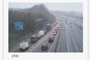
Drivers are warned to take care on the roads as icy conditions are expected across Greater London, Kent, Surrey and Sussex.
Some snow showers could turn “quite heavy”, the Met Office said, adding that a few places could see 1-3cm of snow cover, mainly over the north Downs and on grassy surfaces.
The UK Health Security Agency has issued a cold weather alert covering the whole of England till Friday.
The cold snap is expected to last till the end of this week and comes as some regions are still trying to grapple with flooding following intense rainfall.
As snow began to fall in parts of the UK this morning, the Met Office has warned that more icy conditions are on their way this week.
Here is some of their advice for driving safely:
Culled from Independent